

Maprooms turn ‘shapeless’ climate data into powerful tools of action
‘Maprooms’ are freely accessible, online analytical and visualization tools to make climate data more usable. Building upon the success of these innovations led by AICCRA and its partners, they are now being tailored and scaled to support adaptation in African agriculture.
"I feel like I'm sitting on a pot of gold—There is such a wealth of information in the Maprooms!" declared Kabenuka Munthali, Senior Agricultural Research Officer for the Zambia Agriculture Research Institute (ZARI).
Munthali, one of more than thirty people who have been trained in November 2022 in Zambia and Kenya on ‘Maprooms’ developed by the Enhancing National Climate Services (ENACTS) initiative, made this statement at a ‘training of trainers’ workshop in Lusaka, Zambia.
Header image | Participants from the Zambia Meteorological Department (ZMD) practice navigating through different ‘Maproom’ products available for the agricultural sector during a November 2022 ‘training of trainers’. The training provided an important opportunity for ZMD to interact with key institutions in the agricultural sector to better understand their climate information needs.

Munthali joined other participants from institutions like his at the national level, which play a key role in promoting the tailoring and use of climate information and services for the agricultural sector.
So, what has him so excited?
The answer, in short, is a suite of free, location and sector-specific online analyses and visualizations of climate data known as ‘Maprooms’, which support decision-making and adaptation in agriculture and other sectors.
Developed through interaction between those who produce climate information—the national meteorological services—and those who ultimately use it, the Maprooms are demand-driven products designed to turn shapeless climate data into actionable information for decision-making.
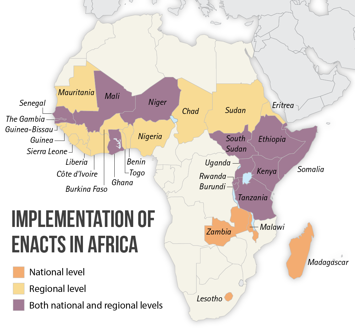
The maprooms have been implemented not just in Zambia and Kenya, but in more than 20 other (primarily African) countries.
In all these countries, they represent a big advance in efforts to support locally led climate adaptation. There are a couple of reasons for this.
Firstly, the Maprooms are linked to rich sets of nationally owned data at very high spatial resolution of 4km. Think of a net stretching around the entire globe, with each square in the net measuring four by four kilometers. Such fine resolution makes location-specific analysis of past, current, and future climate information finally possible in parts of Africa.
This is game-changing for millions of farmers who are dependent on rain-fed agriculture, because it enables the network of actors who support them, such as national research institutions, ministries of agriculture, and the agricultural extension systems, to provide locally relevant information that facilitates agricultural planning.
This includes important information such as when the rainy season is likely to start, how much rainfall can be expected, and other key parameters that can make the difference between food security and insecurity for a family.
Who uses Maprooms and ENACTS data?
- National meteorological services
- Ministries of agriculture, including agricultural extension agents
- Universities
- Research institutions
- Regional climate centres such at the IGAD Climate Prediction and Applications Centre (ICPAC) in East Africa
- UN agencies like the World Food Program (WFP) and Food and Agriculture Organization (FAO)
- Private index insurance companies
- Non-profits and NGOs
John Kisangau from the Kenya Agricultural and Livestock Research Organization (KALRO) says:
"For long, accessing climate information and data for us to assist users has been a challenge. While before we could only get information up to a resolution spanning nine kilometers. With these Maprooms, we are going to get more granular information and data. And what's more, these datasets are already translated, tailored, and put in one portal where any user, technical or not, can get that information. It's a great initiative."
While other initiatives that bring climate information services to the local level do exist, the high-resolution products made available in the ENACTS maprooms represent the only global initiative that recognizes and leverages local, on-the-ground station data provided by national meteorological services.
The ENACTS maprooms combine this local data with satellite rainfall estimates and climate model reanalysis products to enable high-quality, spatially, and temporally complete datasets.
Critically, these datasets are owned by the countries themselves, who can turn theoretical climate information into useful decision support products and services that support climate adaptation.
As Tufa Dinku, Head of the ENACTS initiative at the International Research Institute for Climate and Society (IRI), explains:
"Not all information is created equal. Even when researchers and meteorological agencies strive to produce information that users need, significant barriers may remain which inhibit theoretically useful information from actually being usable. We need to ensure those who generate climate information and those who use it come together regularly to make sure this information is transformed into sector-relevant and decision-relevant products."
Bringing together all the partners
AICCRA-hosted workshops in Kenya and Zambia have scaled the ENACTS approach to ensure that is exactly what happens on a consistent and sustained basis.
This means bringing together all parties that play a role in promoting the use of climate information and services and broader resilience and building their capacity to extend these tools and knowledge to those in the agricultural sector who need it most.
In Kenya, an October ‘training of trainers’ on maprooms brought together the Kenya Meteorological Department (KMD) alongside the main institutions responsible for tailoring, communicating, and otherwise building capacity to understand climate information for its use in the agricultural sector, especially at the most local levels interfacing with farmers.

Participants from the October 2022 ‘training of trainers’ on Maprooms in Kenya pause for a photo outside of the Sarova Panafric Hotel in Nairobi.
This included the decentralized county offices of KMD, KALRO, and those working with the Ministry of Agriculture, Livestock, and Fisheries (MoALF), particularly its agricultural extension system which works most closely to advise farmers on best and climate-smart practices.
Similarly, the Zambia ‘training of trainers’ in November brought together the Zambia Meteorological Department (ZMD) alongside ZARI, the Ministry of Green Economy and Environment (MGEE), the Water Resources Management Authority (WARMA), and the Ministry of Agriculture (MoA), and AICCRA core partners from the International Crops Research Institute for the Semi-Arid Tropics (ICRISAT) and the International Water Management Institute (IWMI) for this same purpose of promoting usability.
Watch | Training the trainers on Maprooms in Zambia
Dominic Namanyungu, Principal Extension Methodologist of Zambia's MoA, put it:
"For a farmer, the changing climate is not just about carrying an umbrella on a rainy day. It influences every aspect of a farmer's decision-making process and planning. So, this information, not just data, needs to come to them in a way they can actually utilize and make a decision with."
ZMD's own 'Climate and Agriculture Maproom' for example, help to do just this.
By allowing users to explore things like when the rains have historically started and stopped, how long the rainy season has tended to be, or how much rainfall has fallen for any given area where those supporting farmers can be better able to tailor their inputs advice to them. This is now possible at even the district level, where many governments agricultural planning decisions related to seed and fertilizer distribution are made.
In the same way, ZMD's 'Seasonal Forecast Maproom’ allows users to see the full probability distribution that rainfall will exceed or not exceed certain rainfall amounts for the upcoming season at any location, supporting more evidence-based decisions critical to livelihoods, such as crops or varieties to promote, when to plant, and more.

Participants from the November 2022 ‘training of trainers’ on Maprooms in Zambia pause for a group photo at the Radisson Blu Hotel in Lusaka.
Moreover, analyses from Maprooms, which are presented as maps and graphs, and which are freely downloadable in a variety of common formats, are automated, allowing for easy integration in reports, strategies, or other documents and enabling even non-technical users to access robust information critical for agricultural planning and even emergency response with just a click.

"There is a need to repackage the science," says Dominic Namunyungu, "as these Maprooms have done. It is my wish that every person who is offering extension services or advisory services can also have a taste of what these Maprooms are, because these Maprooms can help inform not only themselves, but also the farmers to improve the kind of farming they are doing."
Responding to longstanding demand, AICCRA is developing curricula for targeting the agricultural extension systems of Kenya and Zambia to be deployed from 2023, so they are equipped with critical knowledge and skills to assess climate risk and how to use and interpret Maprooms.
Integrating best-available climate information and products like Maprooms into agricultural extension systems helps to ensure they are a sustainable innovation in the hands of colleagues from across private and public institutions with the mandate to scale climate information services and climate-smart agriculture in these countries.

To promote a better enabling environment for developing such services, both countries are also developing their own National Framework for Climate Services (NFCS).
These frameworks will systematize the coordination between all stakeholders, (especially those present at the workshops) to improve the production, tailoring, and delivery of climate information that truly meets real needs, and not just perceived needs of farmers and the network of actors that support them.
"The National Framework for Climate Services will help our institutions to better collaborate on the co-production of climate information products like Maprooms," said Kenneth Sinachikupo of ZMD, who is at the forefront of developing Zambia's NFCS.
"And it will enhance their ownership and development. It is important to take forward these initiatives to have a positive impact on the Zambian community" he added.
Authors
Amanda Grossi, Senior Staff Associate, International Research Institute for Climate and Society (IRI)
Francesco Fiondella, Director of Communications, International Research Institute for Climate and Society (IRI)
Further reading
- Transforming Access to and Use of Climate Information Products Derived from Remote Sensing and In Situ Observations by Gloriose Nsengiyumva et al.
- Enhancing national climate services: How systems thinking can accelerate locally led adaptation by Amanda Grossi and Tufa Dinku
- Enhancing National Climate Services (ENACTS) for development in Africa by Tufa Dinku et al.
- Training of Trainers (ToT) on Enhancing National Climate Services (ENACTS) Maprooms for Users in Kenya
- Training of Trainers (ToT) on Enhancing National Climate Services (ENACTS) Maprooms for Users in Zambia