

Met agencies and universities embrace the "can do tool" enriching climate data for African agriculture
Climate data is the backbone of climate-smart agriculture. But for many countries in Africa, the collection of climate data has been seriously inadequate and, even when available, poorly accessible and of inconsistent quality.
Growing use of the Climate Data Tool (CDT) is ensuring these spatial and temporal gaps are no longer hindering efforts to make African agriculture climate-smart.
Across Africa, there has been a decline in the availability and quality of weather observations.
Weather stations, flung far across countries to collect weather and climate data, are costly to maintain and difficult to access.
As a result, they are few and far between, and when existing, often poorly maintained.
In some places, it is the number of stations that is most problematic. But in other places, even when numbers of stations are adequate, their distribution is uneven as most stations tend to be located in towns and along major roads that are easier to access.
This means the rural areas which could benefit most from such observations are poorly covered and represented in terms of data. This is the ‘spatial’ problem.
For those preparing for a changing climate with increasing extremes, this lack of ability to collect quality climate data and produce a historical record of observations can be crippling.
To understand the future and produce a forecast, for example, you must understand the past. Understanding historical trends and patterns is paramount. This is the ‘temporal’ problem.
But thanks to the Climate Data Tool (CDT), these spatial and temporal gaps are no longer hindering efforts to make African agriculture climate-smart.

Example of a typical weather station and its component measurement instruments (Ethiopian Meteorological Institute regional office for Eastern and Central Oromia). Photo credit: AICCRA/Amanda Grossi
The Climate Data Tool
The Climate Data Tool (CDT) is a free, open-source software package that simultaneously helps to fill these data gaps and enables national meteorological agencies—and students alike—to analyze their own local climate data to generate new research and products.
CDT has an easy-to-use graphical user interface based on a statistical computing language called “R”. Now operational in all six AICCRA target countries, it is being used by the national meteorological agencies and universities alike seeking to equip students with higher level skills in climate data analysis.
First and foremost, CDT was originally designed to help national meteorological agencies to improve their data quality and availability and overcome spatial and temporal gaps in the historical record. It does this by blending quality-controlled on-the-ground observation data with freely available global products.

Distribution of weather stations across Africa since 1950 (left) and number of weather stations since 1950 (right). Source: IPCC Sixth Assessment Report
Patchy coverage of national weather stations is corrected and compensated through use of satellite data. At the same time, rainfall estimates from satellite data are enhanced by actual observations at weather stations.
The result is a more spatially and temporally complete dataset stretching back more than 40 years (1981 to present).
This much richer data can inform numerous climate services, such as forecasts which inform farmers and those in other sectors besides agriculture which are also vulnerable to climate change.
What can you do with CDT?
- Organize and combine weather station and proxy (satellite, reanalysis) data
- Assess data availability
- Assess and correct data quality issues
- Extract data from gridded* products, including satellite, reanalysis, and combined data products, at any point or for any selected area
- Analyse and visualize weather station datasets and gridded datasets
*What is gridded data?
It means data on a grid (squares). Some data products use squares 1 km by 1 km in resolution. Others use 4 km by 4 km.
For example, think of a net stretching around the entire globe, with each square in the net measuring four by four kilometers. Such fine resolution of data makes location-specific analysis of past, current, and future climate information possible.
Learn more in Maprooms turn ‘shapeless’ climate data into powerful tools of action
Local climate data for farmers
CDT has also become a powerful, dynamic, and intuitive tool for a wide range of data quality control, analysis, and visualization functions.
It has been embraced by national meteorological agencies, universities, and African regional organizations responsible for enhancing climate services, who are seeking to equip graduates with strong data analysis skills to be used in sectors affected by climate change.
“Life before CDT was very difficult because we were using different software for different functions, which required knowledge of various programming languages,” says Ismael Lutta of the IGAD Climate Prediction & Applications Centre (ICPAC), East Africa’s regional climate center. “CDT has so many functions, and I find all of them very important and user-friendly. You don’t need to know a programming language, so we really thank the developers for that. They’ve made it so simple!”
Accelerating Impacts of CGIAR Climate Research for Africa (AICCRA) has been scaling up access to (and use of) CDT through capacity development in various African countries and through Africa’s regional organizations.
To date, more than 200 people from the national meteorological services of Ethiopia, Kenya, Zambia, Senegal, Ghana, and Mali have been trained on CDT, alongside staff from the regional climate centers of excellence ICPAC (covering East Africa) and Agrhymet (covering West Africa).
Furthermore, training on these much-needed climate analysis tools is being embedded in higher education systems through its integration with university curricula.
In Ethiopia, a new five-chapter Climate Risk Management in Agriculture (CRMA) curriculum co-developed and piloted with more than a dozen agricultural universities in 2023 includes a dedicated chapter on climate data and analytics, including guidance on how to download and use CDT to support students in their research and theses involving climate data.
“This curriculum is filling in practical gaps that we’ve observed for climate risk management for a very long time,” says Professor Kefelegn Getahun of Jimma University who partook in the co-development and piloting the CRMA curriculum at his university last year. “I know students will appreciate things like CDT…because they really used to suffer trying to get this [climate] information for their research!”

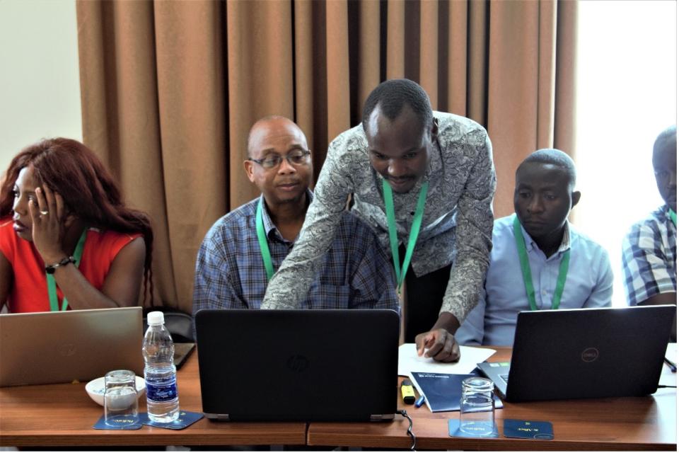
Rija Faniriantsoa (top) trains Ghana Meteorological Agency (GMet) Deputy Director Francisca Martey (right) and GMet staff member Joshua Asamoah (left) on the various functions of the Climate Data Tool.
Most recently, in August 2024, the Ghana Meteorological Agency (Gmet) trained more than 40 newly recruited staff in CDT.
“I am still trying to figure out what the Climate Data Tool cannot do,” said Erasmus Antwi, who participated in the training. “From downloading satellite products to even validating of these products from their different model sources with actual observed station data…. I think its name should be changed to the 'Can Do Tool' (CDT)!”
AICCRA’s partners are continuing to scale access to and use of CDT at regional and national meteorological agencies, as well as through education systems through creative partnerships with regional and Africa-wide organizations such as the Regional Universities Forum for Capacity Building in Agriculture (RUFORUM) and the Institute of Meteorological Training and Research (IMTR), a World Meteorological Organization (WMO) regional training center.
"There's a difference between data and information, and between information and insights," says Ghana Meteorological Agency (GMet) Deputy Director Francisca Martey.
Tools like CDT, Francisca argues, ensure the data that forms the backbone of climate services is of the highest quality possible, and is organized and analyzed in ways that tell a story. “The ability to do this underpins systems that help farmers to plan their lives and livelihoods, and to anticipate and prepare for climate patterns and extremes," she noted.

Participants of the August 2024 training on the Climate Data Tool (CDT) at GMet pause for a photo.
In their own words
CDT was developed by Rija Faniriantsoa, a researcher at the International Research Institute for Climate and Society (IRI) at Columbia Climate School, after seeing firsthand the challenges that meteorological agencies faced during his time at Madagascar’s national meteorological agency.
“Trying to understand the story that climate data is trying to tell you when there are huge gaps in observations over time and space is like trying to make sense of a book where many pages are ripped out.” says Rija.
“CDT helps to fill in those missing pages by using global satellite products or climate model reanalysis products where observations may be missing. The result is a strong and high-resolution climate dataset (4 km) that enables location-specific and thus decision-relevant products for farmers to be developed.” he added.
Authors
Amanda Grossi, Research Team Leader for Climate Action and Resilient Food Systems, Alliance of Bioversity International and CIAT
Tufa Dinku, Senior Research Scientist, International Research Institute for Climate and Society, Columbia Climate School
Further reading:
- The Climate Data Tool: Enhancing Climate Services Across Africa
- Challenges with availability and quality of climate data in Africa
- Enhancing national climate services: How systems thinking can accelerate locally led adaptation
- Enhancing National Climate Services (ENACTS) for development in Africa
- Introduction to the Climate Data Tool (CDT): Remote Training with Ethiopian Universities
- Training of Trainers (ToT) on the Climate Risk Management in Agriculture (CRMA) University Short Course Curriculum
- Transforming Access to and Use of Climate Information Products Derived from Remote Sensing and In Situ Observations
- ENACTS: Risk, Resilience, and the Revitalisation of Climate Services in the Developing World
Related content

Maprooms turn ‘shapeless’ climate data into powerful tools of action
Meet the next generation of Africa’s climate forecasters
